Description
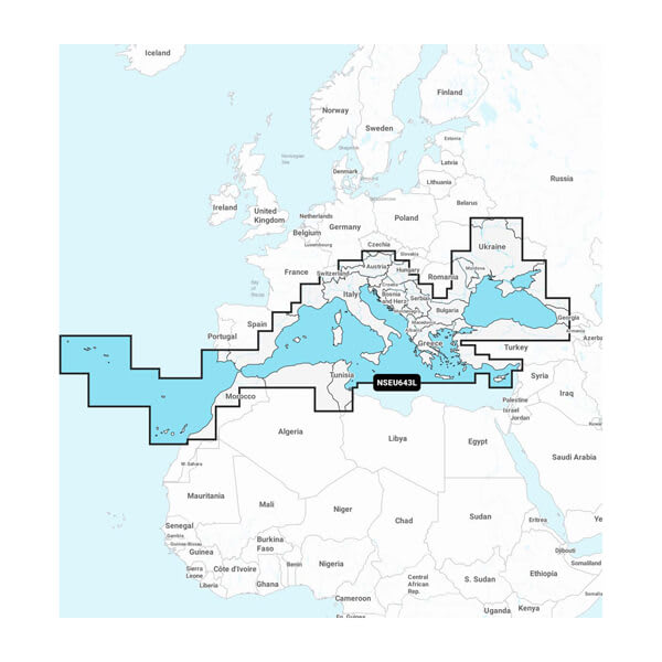
GARMIN 010-C1272-20 Marine Cartography; NAVIONICS+; Compatible With Garmin GPS Navigation Systems/ Chart Plotters; Detailed Coverage Of Mediterranean And Black Seas; Region Code: NSEU643L; On SD/Micro-SD Card With Auto Guidance Technology, High-Resolution Relief Shading, High-Resolution Satellite Imagery, Aerial Photography, 3D Fisheye View, 3D Mariner Eye View And Dynamic Lake Level

Reviews
There are no reviews yet.